Background
The Grampian project is focused on identifying gold and base metal mineralisation within the highly prospective Grampian Terrane. This geological terrane consists mostly of metasediments and volcanics of Dalradian age and is a direct continuation of the Dalradian gold province of Northern Ireland which hosts the Curraghinalt and Cavanacaw gold deposits.
The British Geological Survey (BGS), which has completed geochemical surveys over the entire area held by Scotgold, has repeatedly expressed the view that there are significant metalliferous deposits yet to be discovered in the Dalradian of Scotland.
The geology team at Scotgold employ a systematic approach to exploration, using efficient and effective techniques in order to discover and define prospects.
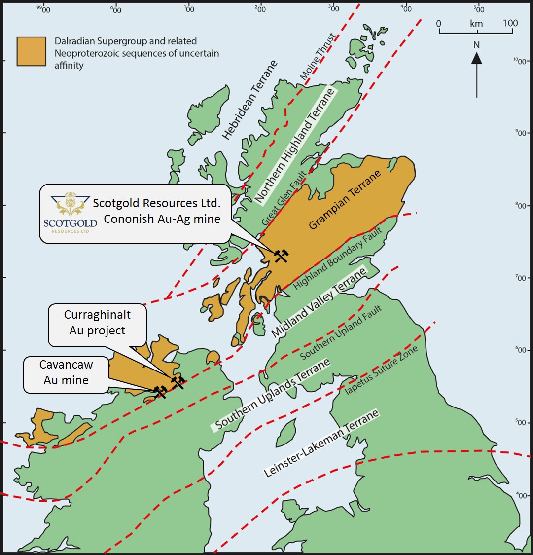
The location of the Scotgold’s Cononish Au-Ag mine and Irish gold projects within the highly prospective Grampian Terrane.
Option Agreements
Scotgold Resources Ltd. Currently holds 13 option agreements with the Crown Estate Scotland which constitute the company’s Grampian Project within the Scottish Highlands. These option agreements cover a substantial area of just under 3000 km², with the vast majority located outside of the Loch Lomond and the Trossachs National Park. The company holds the options for the next six years, from 2018 subject to satisfactory performance on a two-yearly review process.
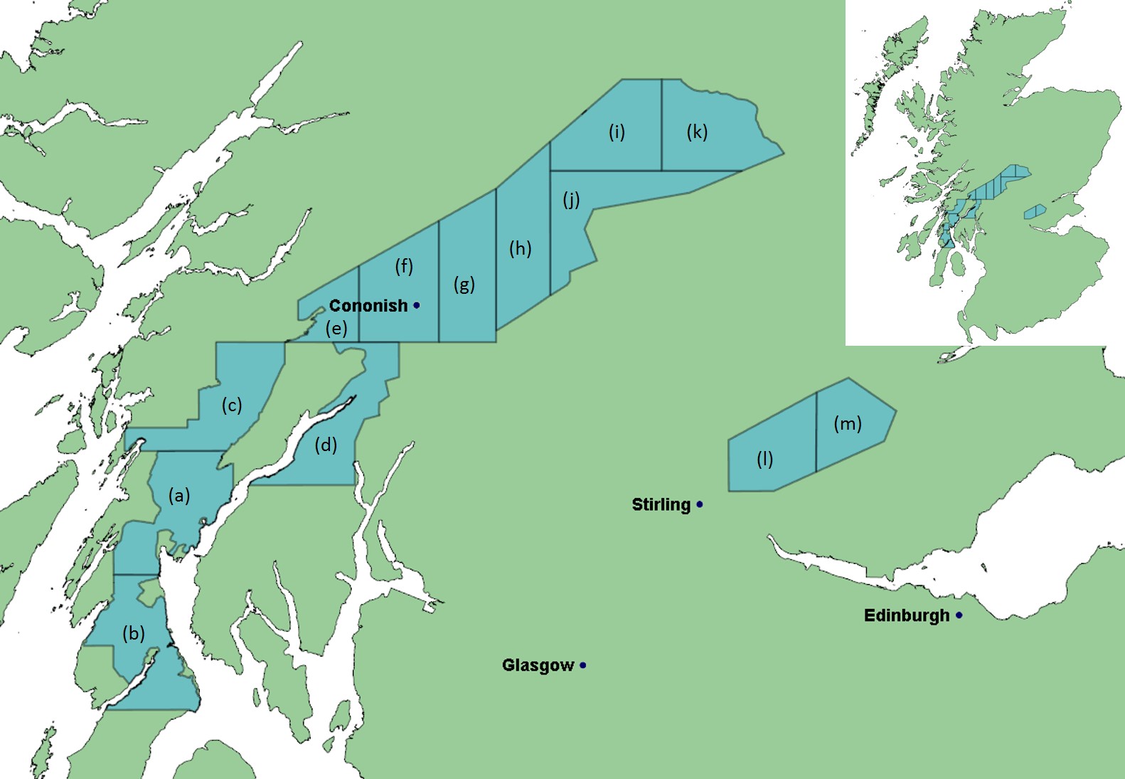
Key to Scotgold’s 13 option agreements: (a) Knapdale North (250Km²), (b) Knapdale South (250Km²), (c) Inverliever West (250Km²), (d) Inverliever East (233Km²), (e) Glen Orchy West (103Km²), (f) Glen Orchy Central (242Km²), (g) Glen Orchy East (241Km²), (h) Glen Lyon West (246Km²), (i), Glen Lyon North (244Km²), (j) Glen Lyon South (243Km²), (k) Glen Lyon East (247Km²), (l) Ochills West (189Km²), (m) Ochills East (150Km²).
Structural Study
Previous exploration has identified the Tyndrum-Glen Fyne fault – one of the major fault structures of the Grampian domain, as a zone of significant potential for lode-hosted gold mineralisation.
An in-depth structural study conducted by Dr. Gumiel and Dr. Arias in 2015, focused on the structural setting of the Tyndrum area. The study established that there is likely to be preferential fracture orientations that host mineralisation. This structural study combined with other data sources such as geochemical data was used to create a weighted prospectivity map (see below).
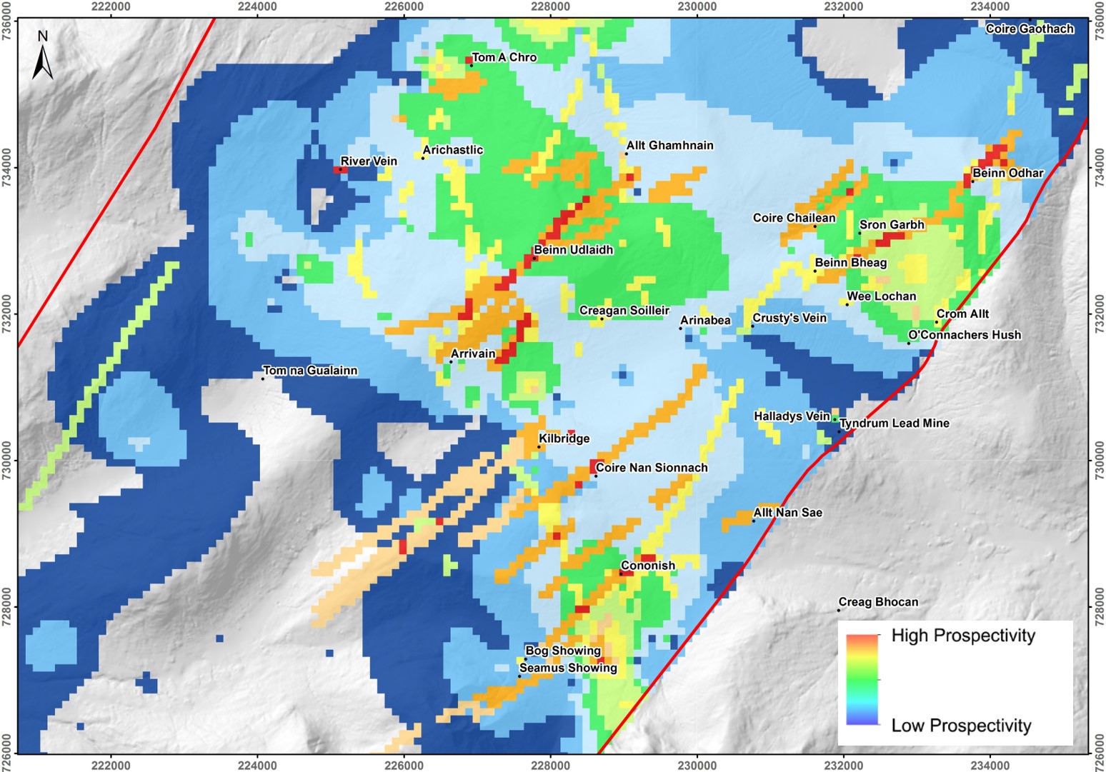
Prospectivity map produced by the structural study carried out by Dr. Gumiel and Dr. Arias in 2015. The findings of this study have been used to prioritise the exploration focus over existing prospects.
Current Activities
The successful testing and calibration of the ‘ionic leach’ technique in the summer of 2018, has given the geology team the confidence going forwards to employ this technique across it’s license areas. Current exploration activities include:
- Regional stream sediment sampling using the ionic leach technique in order to identify prospective areas.
- Detailed local and regional geological mapping to investigate possible lithological and structural settings for mineralisation.
- Soil sampling using the ionic leach technique over high priority prospects such as Beinn Udlaidh.
- Geophysical surveys using techniques such as IP (induced polarisation) and magnetics over high priority prospects in order to define the sub-surface structure of known targets in more detail.
- Historical data gathering as well as analysis and re-evaluation of existing geophysical and geochemical data produced by previous exploration across the Grampian terrane.
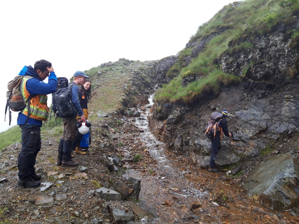
Scotgold geologists examining a mineralised outcrop with two MSc students from the Camborne School of Mines.