Ground Truth from Orbit: The Remote Sensing Revolution Reshaping Scottish Mineral Exploration
For most of recorded history, finding gold in Scotland has demanded one of two things: proximity to water — specifically the alluvial streams draining the Southern Uplands and Highland massifs — or access to detailed geological knowledge accumulated over decades of fieldwork. Both requirements imposed significant barriers. The first confined productive prospecting to well-documented catchments. The second placed serious exploration firmly within the domain of well-funded companies and their retained geologists.
A convergence of satellite remote sensing, open-access geological datasets, and machine learning is now dismantling both barriers simultaneously. The implications for Scottish gold exploration are substantial — and not entirely straightforward.
What the Technology Actually Does
The term 'remote sensing' covers a broad family of techniques, and precision matters when assessing their application to mineral exploration. At the most accessible end of the spectrum, freely available satellite platforms — including the European Space Agency's Sentinel-2 constellation and NASA's Landsat archive — provide multispectral imagery capable of distinguishing surface mineralogy across large areas at resolutions useful for regional targeting.
Gold mineralisation in Scotland is typically associated with hydrothermal systems that alter surrounding rock in characteristic ways. Iron oxide staining, clay mineral alteration halos, and silicification — all detectable through multispectral and hyperspectral analysis — act as surface proxies for the deeper structural environments where economic gold concentrations are most likely to occur. Satellite imagery cannot see gold directly; it can, however, identify the geological context that experience and modelling suggest is most likely to host it.
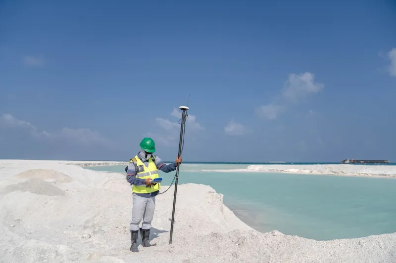
Beyond passive imaging, airborne geophysical surveys — magnetic, radiometric, and electromagnetic — have been conducted across significant portions of Scotland by the British Geological Survey and its predecessors. Much of this data is now publicly accessible through the BGS portal, providing a foundational layer that, until recently, required specialist interpretation to interrogate effectively.
Machine Learning as Force Multiplier
The integration of artificial intelligence into geological modelling represents the more transformative element of this technological shift. Machine learning algorithms, trained on known mineralised systems, can be applied to combined datasets — satellite imagery, geophysical surveys, stream sediment geochemistry, and historic drilling records — to generate prospectivity models that rank ground by its statistical similarity to productive deposits.
Several platforms now offer this capability at price points accessible to junior exploration companies and, in some cases, to well-resourced independent prospectors. Tools such as those developed by Minalytix, Earth AI, and various academic spinouts from UK geology departments allow users to upload and integrate disparate datasets, apply trained predictive models, and receive spatially explicit output identifying priority targets.
For Scottish exploration specifically, the combination of BGS open data, Sentinel-2 multispectral coverage, and stream sediment geochemistry compiled during the Mineral Reconnaissance Programme of the 1970s and 1980s provides a surprisingly rich foundation. The MRP data, collected before the computational tools existed to exploit it fully, is now being revisited with modern analytical methods — and generating targets that the original surveys' authors could not have identified.
Case Studies in Data-Led Discovery
The practical impact of these approaches is perhaps best illustrated through specific instances, even where commercial sensitivity limits full disclosure.
In the Southern Uplands — a region whose gold potential has historically been underestimated relative to the Highlands — machine learning prospectivity modelling applied to combined geophysical and geochemical datasets has flagged structural corridors that received limited follow-up during the original MRP campaign. At least two junior exploration companies are understood to have used such analysis to prioritise licence applications in the region, targeting ground that conventional desk-based review had not elevated to priority status.
In Sutherland, where alluvial gold has been recovered since the 1860s rush at Kildonan, satellite-derived structural mapping has been used to trace the bedrock sources feeding productive stream reaches — a longstanding challenge that field mapping alone has struggled to resolve definitively. The ability to analyse fault geometry and lithological contacts at landscape scale, without the access constraints that ground surveys impose, has opened new lines of inquiry in areas where land access permissions have historically been difficult to secure.
Democratisation or Consolidation?
The narrative most commonly attached to accessible exploration technology is one of democratisation — the levelling of a playing field previously tilted sharply towards well-capitalised operators. That narrative contains genuine substance. A licensed prospector with analytical aptitude and a modest software subscription can now generate targeting intelligence that would, a decade ago, have required a team of geologists and a six-figure survey budget.
Yet the counter-argument deserves equal consideration. The most powerful applications of machine learning in mineral exploration — those integrating proprietary drilling databases, commercially acquired hyperspectral imagery, and bespoke model training — remain the preserve of larger companies with the capital and technical staff to deploy them effectively. The gap between what is accessible and what is optimal remains wide.
Furthermore, the ability to identify prospective ground is only one element of the exploration challenge. In Scotland, as this publication has examined previously, the planning and regulatory environment governing mineral extraction imposes constraints that no amount of satellite data can resolve. A junior explorer who uses AI prospectivity modelling to identify a compelling target in a National Scenic Area or adjacent to a Special Area of Conservation faces precisely the same permitting obstacles as one who arrived at the same ground through traditional methods.
The technology, in other words, sharpens the targeting problem without addressing the access problem. For many Scottish targets, the binding constraint on exploration progress is not the identification of prospective ground — it is securing the permissions required to test it.
Implications for the Scottish Exploration Community
For practitioners operating in the Scottish gold sector — whether as licence holders, investors in junior companies, or independent prospectors — several practical conclusions emerge from this landscape.
Open-access datasets from the BGS and ESA represent genuinely underutilised resources. The barrier to engaging with them is now primarily analytical rather than financial, and the growing availability of accessible software tools means that threshold is falling. Prospectors willing to invest time in developing basic geospatial literacy will find that the evidentiary foundation for target selection has improved markedly.
For investors assessing junior exploration companies operating in Scotland, the quality of a company's data integration and prospectivity methodology is now a meaningful differentiator. Companies that can demonstrate rigorous, technology-assisted target generation — and articulate clearly why their priority ground scores highly against multiple independent datasets — deserve closer scrutiny than those relying solely on historical anecdote or surface sampling.
The technology does not guarantee discovery. Scottish gold mineralisation is structurally complex, and the relationship between surface indicators and economic depth mineralisation is rarely linear. What remote sensing and machine learning provide is a more rational basis for deciding where to look first — a meaningful advantage in a sector where exploration capital has always been finite and the ground available for investigation has always been vast.